Throughout France there is a network of variously named public rights of way. One of the most frequently encountered by walkers is the
chemin rural (plural
chemins ruraux). These are (usually) unpaved tracks owned and maintained by the local
commune. They are almost always ancient laneways, winding through farms and today used by walkers, horse riders, hunters and farmers. Sometimes they are unmarked, but usually they have a small sign at either end with the letter R, C or V and an a number to identify them. They also frequently have the standardised walking trail symbols posted along them and appear on maps as part of the national hiking trail (
randonnée) network. Even when they appear to be private farm tracks, the public is permitted to walk them. Walking them in all seasons is a great way to get to know the wildlife of this area, as they are usually long thin grasslands bordered by hedges, woodland or agricultural land, and sometimes even aquatic habitats such as streams, ditches, springs and ponds. You are unlikely to meet another person on most of them.
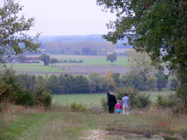 |
| A chemin rural near Yzeures sur Creuse, October. |
 |
| A chemin rural near Yzeures sur Creuse, October. |
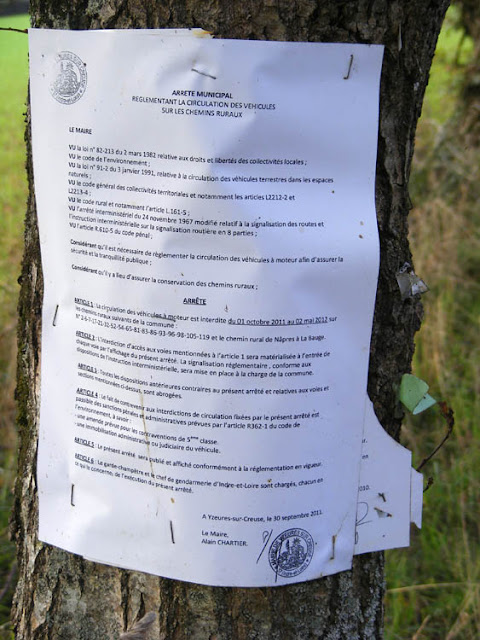 |
| A notice issued by the local authority who has responsibility for maintaining this chemin rural, stapled to a trackside tree. It says that motorised vehicles are not permitted on this track between October and May ie the months when it is likely to be wet. The commune very sensibly does not want the track churned up and ruined by hunters' vans or farm machinery. |
 |
| Bird watching in the Brenne down a track near la Maison du Parc. |
 |
| Bird watching in the Brenne, near l'Etang vieux. This track had a sign temporarily banning agricultural vehicles because it was flooded, however that didn't stop anyone on foot who was prepared to take off their boots and slosh. |
 |
| The sign on this track in the Brenne says 'Attention. Track under repair. Do not tow vehicles down it.' There was no problem (apart from ankle deep water) in walking down it. |


Due to the abuse by motorised transport putting walkers, cyclists, animals like dogs, and children with parents at risk on some of these chemin de communes (ours here is through the forest), I am trying to start a public campaign to limit the speed and frequency of access for cars, motorbikes and quad bikes. The track was once banned for vehicles along part of the length but then the commune bowed to local pressure and opened it up again. Our daily walks are ruined by motorised vehicles speeding along at up to 80 kph, but I thought rules were that these should 'roule a pas' and give way to other users like cyclists and pedestrians. The local councillors don't really think it is of any concern as they never use these tracks and they cross the departmental boundary.
ReplyDeleteHow should I start to achieve a change such as a speed limit and notices warning motorised users?